Fatal Boeing 737 Crash in South Korea

Jeju Air Flight 7C2216, arriving from the Thai capital of Bangkok, at South Korea’s Muan Airport (MWX), crashed at around 9am local time (00:00 GMT/UTC) on Sunday, 29 December 2024.

My condolences to the families and loved ones of those who died or were injured in this fatal aircraft accident.

Pictures of the Jeju Air Boeing 737-800 landing[1] show that no landing gear can be seen deployed. A video image shows the aircraft skidding down the runway at high speed. The aircraft is wings level. It is reported the aircraft overrunning the runway and colliding with a wall or ramp. The video image does suggest that the aircraft engine thrust reversers were deployed. This is wrong. Weight on wheels is needed for deployment.

MWX runway 19 has a Landing Distance Available (LDA) of 2800 m. The local visibility was reported as 9000m and the wind speed at 2kt.

Was the pilot in command trying to go around? The accident flight recordings should answer this question. That is from the aircraft Flight Data Recorder (FDR) and Cockpit Voice Recorder (CVR).

This remains a hope. Reports are that the FDR has been damaged. This should not be a surprise given the nature of the impact it suffered. However, both FDR and CVR are designed and tested to survive extreme cases.

The South Korean Ministry of Land, Infrastructure and Transport says that the accident flight and voice recorders have been recovered[2].

Jeju Air is a popular South Korean low-cost airline. The airline was established in 2005.

A full independent accident investigation will no doubt take place. That is in accordance with the standards and recommended practices of ICAO Annex 13.

Current media speculation surrounding possible causes of this Boeing 737 accident do not offer any satisfactory explanation for the sequence of events. For example, it would be astonishing if the root cause of the accident was a bird strike or multiple bird strike shortly before landing. The aircraft has several means to deploy its main undercarriage.

It is likely that safety culture, controller and pilot training, and airport facilities are bigger factors in this fatal accident than the fact that it involved the loss of a Boeing 737-800 aircraft.

NOTE: Boeing 737 “If the gear fails to extend properly or hydraulic system A is lost, the gear can be manually extended by pulling the manual gear extension handles, located in the flight deck.” Landing Gear

POST: The impact test in the applicable technical standards EUROCAE ED55 (FDR) and ED56A (CVR) are demanding. The recorder’s crash protected memory module is fired out of a canon into a shaped target to simulate an accident scenario. It must be readable afterwards.


[1] https://www.independent.co.uk/tv/news/south-korea-jeju-air-crash-b2671085.html

[2] https://www.bbc.co.uk/news/live/c4glr85l2ldt

SONAR in Ocean Wreckage Recovery

Finding aircraft wreckage in the deep ocean is possible. However, it requires a degree of good fortune. Most of all, it requires the searcher to look in the right places. Lots of other factors come into play, particularly if the ocean floor is uneven or mountainous.

The primary tool for imaging the ocean floor is SONAR. That’s using the propagation of sound in water. SONAR can be of two types. One is called “passive” and the other called “active”.

The first case is like using a microphone to listen to what’s going on around. Of course, the device used is named appropriately: a hydrophone. It’s a device tuned to work in water and not air. Afterall, sound travels much faster in a liquid than it does in air.

Passive SONAR depends on the object of interest making a noise. Just like we have directional microphones so we can have directional hydrophones.

Passive SONAR is only useful if the aircraft wreckage is making a noise. Since in the case of Flight MH370, the battery powered underwater location beacons attached to the accident flight recorders have long since stopped working this kind of SONAR isn’t going to be much use.

Active SONAR is analogous to RADAR. That is where a pulse of high frequency sound is sent out through a body of water. Then sensitive hydrophones pick up a reflection of that pulse. It is detected and all sorts of miraculous digital signal processing is done with the acoustic signal, and an image is then formed. From that displayed image the human eye or sophisticated algorithms can make sense of what they are looking at on the sea floor.

Active SONAR can give both range and bearing (direction). Timing the sound pluses from their transmission to reception can give a way of calculating range. Or distance from the object providing a reflection. Bats know how to do this as they navigate the dark.

In sea water, there are complications. Sound does not always travel in a straight line in sea water. The speed of sound in water depends on salinity, temperature and pressure. All three of these factors can be measured and compensated for in the SONAR signal processing that I mentioned above. Helpfully at ocean depths beyond a kilometre the calculations become easier.

The average depth of the Indian Ocean is over 3 kilometres. It’s mountainous underwater too. So, what are the chances of finding flight MH370 on the ocean floor after 10-years[1]? This prospect goes back to my earlier comment. It requires the searcher to look in the right places.

Just imagine encountering the Grand Canyon for the first time. It’s nighttime. An important object is lost in the canyon. You only have the vaguest theories as to where the object has come to rest. With a handheld touch you go out to search. What are the chances of finding the object?

There are several factors that are in your favour. One, you know what the object might look like or, at least, in part. Two, the easy search locations (flat/smooth) may be covered relatively quickly. Three, certain areas of the rocky canyon have already been searched. Still the odds are against finding the lost object without a high degree of good fortune. 

I wish the new planned searchers much good future[2].

NOTE 1: one of my student apprentice projects was to design and build a Sing-Around Velocimeter for use in relatively shallow sea water[3]. It worked but was cumbersome in comparison with the simple throw away devices used for temperature depth profiling.

NOTE 2: To get down to the ocean depths required it’s a side-scan sonar that may be used. This active sonar system consists of a towed transducer array that can be set to work at different depths. Imaging objects on the seafloor and underwater terrain is done as a towed array moves slowly forward through the water. The scanning part is the acoustic beam sweeps left and right. Each scan builds up part of an image.

In operation, as the frequency of the sound in water goes up so does the resolution of a potential image but, at the same time, the range of the sonar system goes down. Thus, a sonar system used for surveying may have low and high frequency settings. Unlike sound in air, here high frequency means above 500kHz.

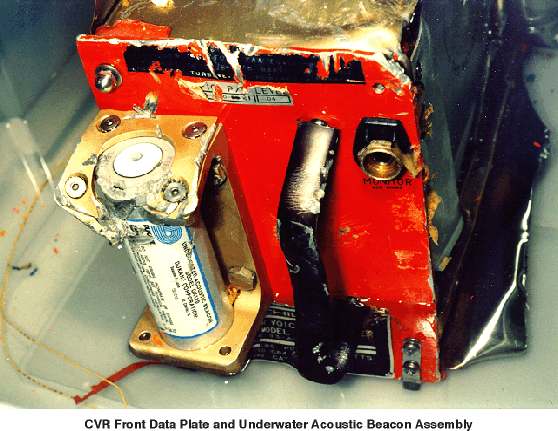
NOTE 3: What will an aircraft accident recorder look like after a decade in the deep ocean? It might have survived well given the nature of the dark cold pressured environment. This picture is of an accident recorder recovered from relatively shallow sea water (Swiss Air Flight 111).

POST: Nice view of what SONAR can do, at least in shallow water Bristol Beaufort wreckage found

[1] https://www.cbsnews.com/news/mh370-plane-malaysia-new-search/

[2] https://www.bbc.co.uk/news/articles/cewxnwe5d11o

[3] https://apps.dtic.mil/sti/tr/pdf/AD0805095.pdf

MH370 and MH17: A Decade On

The unthinkable happened in 2014. One major international airline suffered two catastrophic accidents. These tragic events ran contrary to all the trends in historic aircraft accident data.

In March, flight MH370 disappeared. In July, flight MH17 was shot down. In both cases there were no survivors from these international flights. This remains an unprecedented situation. It is a sobering consideration that such dreadful events were possible in a mature international framework of civil aircraft operations and regulation.

A decade on the pain of those who lost friends, family and colleagues in these tragedies is not diminished. Aviation should not lessen its attention to discovering more about what happened and putting measure in place to prevent reoccurrence of these events.

These two aviation catastrophes are different in respect of causal factors. One remains a mystery but, from what is known, has the hallmarks of an operational accident. The other is undoubtably an aggressive malicious act. Failings in the two elements of aviation safety and security, often viewed separately, are both capable of catastrophic outcomes.

Malaysia Airlines was a State-owned airline in the traditional model. There’s no reason to suppose that the airline harboured deficiencies that led directly to the two fatal accidents. In hindsight, the question is often asked: could both accidents have been avoided?

The extensive underwater search for MH370, in the southern Indian Ocean, resulted in no findings. However, floating debris from the fateful Boeing 777-200ER was discovered. Unlike what happened with Air France Flight 447 were the installed accident flight recorders were recovered from the deep ocean, there has been no such good fortune in respect of MH370.

Accident flight recorders are one of the primary tools for accident investigators. Installed recorders are built and tested to withstand extreme conditions. The reasonable assumption being that they will be found with any aircraft wreckage. The accident of MH370, is one where a deployable recorder may have been beneficial. That is one that ejects from an aircraft when it is subject to the high impact of the sea surface and then floats, possibly away from an accident site. There is a good case to be made for installing both deployable and installed recorders[1]. Particularly a case for long-range international overwater aircraft operations.

The facts surrounding the criminal act of shooting down of flight MH17 are well established. Sadly, in a troubled world it is impossible to say that such malicious acts will never occur again. What is to be done? Avoidance is by far the optimal approach. Commercial flying over warzones, where heavy weapons are known to be used, is extremely foolish. Now, it is good that much more flight planning attention is paid to understanding where conflict zones exist[2].

NOTE 1: On 07 March 2014 at 1642 UTC1 [0042 MYT, 08 March 2014], a Malaysia Airlines (MAS) Flight MH370, a Beijing-bound international scheduled passenger flight, departed from KL International Airport [KLIA] with a total of 239 persons on board (227 passengers and 12 crew). The aircraft was a Boeing 777-200ER, registered as 9M-MRO.

NOTE 2: On 17 July 2014, at 13:20 (15:20 CET) a Boeing 777-200 with the Malaysia Airlines nationality and registration mark 9M-MRD disappeared to the west of the TAMAK air navigation waypoint in Ukraine. All 298 persons on-bard lost their lives.


[1] https://flightsafety.org/files/DFRS_0.pdf

[2] https://www.easa.europa.eu/en/domains/air-operations/czibs

Exploring the Kennet & Avon Canal

It’s the road to the west. The A4 out of London heads towards the west. It’s younger but bigger brother the M4 motorway goes the same way. Going the same way too is the Great Western railway and before that a major waterway, a canal. I guess the ancient roads predate the lot of them given that east-west traffic is an important part of English history. Certainly, the Romans went that way.

I now live at what is roughly the halfway point between London and the west. It’s where what is largely a level route from London starts to rise at a slow pace. That climb made linking rivers, most particularly the London Thames and the river Avon in the west, a challenge. The incentives were evident. So, much potential for trade. Moving heavy commodities around. Canals are truly visionary engineering infrastructure and now an inheritance that’s much treasured.

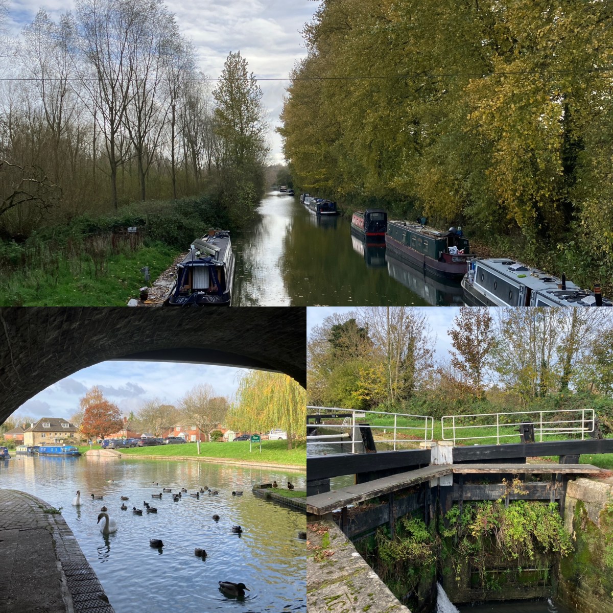
For people who like to walk, like me, canal towpaths[1] provide flat route between towns. A direct waterside route that wanders through lush countryside. Yesterday, I did the 15km between Newbury and Hungerford. Along that stretch, the Kennet & Avon Canal raises about 150 feet but it’s almost unnoticeable. The main signs are the difference between the fast-flowing waters of the river Kennet and the sober slow canal. A littering of canal locks and small brick-built bridges are a feature too.

The Kennet & Avon Canal was constructed between 1795 and 1810. It was eventually killed-off as a commercial enterprise by the construction of the Great Western railway. Being cheaper and faster along the iron road, transport of goods by water couldn’t compete. It’s in this modern time that the canal was restored. It’s been working again for the last 30 years. Now, it’s a centre of leisure pursuits, small businesses and alternative lifestyles.

The canal’s path follows the River Kennet and its narrowing flood plain. I found looking at how the waterflow is controlled by sluice gates and weirs a fascinating part of the walk. Ambling along the canal’s towpath is a great way to venture into the Berkshire countryside. There are a couple of points where the path changes sides and it’s a bit soggy in one or two places but overall, it’s relatively easy walking.

I did see an Otter on the opposite bank. It was a fleeting glimpse. He, or she, slinked away almost before I realised what I was looking at. Quite different from noisy ducks this Otter made virtually no sound or ripples on the water. 

Dotted along the canal near bridges, decaying concrete World War II-era pillboxes are a reminder that this would have been a defensive line if Britain had ever been invaded.

The walk took me under 4 hours. I was exceedingly fortunate with the weather on the day. A cool breeze and intermittent sunshine. Not bad for November.


[1] https://canalrivertrust.org.uk/things-to-do/walking

Travelling Post-Brexit

Ever since Brexit, I’ve had to have my passport stamped in and out of European countries. It’s like a reversion to the days when I got my first British passport. That was back in the late 70s.  It has a frighteningly youthful picture. Occupation – student.

I’m not so phased by the coming changes to European Union (EU) border controls. Naturally, it’s worth asking if Britian has become a more dangerous nation since the time before Brexit when we enjoyed freedom of movement. It’s a pity we didn’t value that freedom a lot more. It was thrown away far too easily.

Today, the electronic border controls expect us to stare at a camera. A securely held, I hope, database is used to check a list of biometric numbers against my image. I guess that’s a sure-fire way of saying that Mr Blogs is indeed someone who looks very much like Mr Blogs. Facial recognition technology has come a long way.

The next steps in tightening-up controls will be fingerprinting[1]. Not in the manner of Sherlock Holmes, with an ink pad. No, in the digital age an ominous machine will scan our fingers and check its records to see that not only does Mr Blogs look as he should but that he’s got the essential characteristics of Mr Blogs.

Certainly, in this new regime British citizens will not be able to overstay in European countries. Ones travel records will be a lot more quantifiable and precise than stamping a piece of paper. That is assuming such digital border control machines will be relatively error free.

One of the benefits of Brexit is that it will be easier to track the movements of British criminals in and out of the EU. The reciprocal will not be true. It will not be easier for British authorities to track continental European criminals in an out of the UK.

Ah the luxury of being a Third Country. Longer ques. More uncertainty. Less privileges.

What’s more is the introduction of the new EU border control systems will be “phased[2]”. This change will not be one big bang. So, different ports and airports will be doing different things at different times. Now, it doesn’t take a genius to see that confusion is most likely.

Travelling in 2025 is going to be more than the usual adventure.


[1] https://commonslibrary.parliament.uk/the-eu-entry-exit-system-and-eu-travel-authorisation-system/

[2] https://www.independent.co.uk/travel/news-and-advice/eu-biometric-border-fingerprint-entry-delay-b2627645.html

Navigating Heights

If I were to explain, the reasoning would go like this. It’s good to have a vivid imagination. As an engineer, it’s essential to be able to create a mental picture of what’s happening. But there’s a downside. Looking at a situation and seeing more than is there, opens the door to imagining all sorts of scenarios that are unlikely.

I’m talking about that experience of peering over a cliff edge to see what’s there. Curiosity being a strong urge. Then pulling back in fright of falling. Often when the ground is solid and safe. Often when nothing more than a spark in the imagination creates an unreasonable fear of falling. The fleeting image I have in mind is looking down at Beachy Head Lighthouse[1].

I have a curious relationship with hights. No, I’m not terrified of heights. It’s just that now and then that fear of falling does kick in. This feeling could be embedded or learnt from an early age. My mother tells a story of me as a toddler being halfway up a ladder. Sacring her. Me being oblivious to any danger and coming to no harm. Growing up on a family farm there was innumerable hazards around every corner.

One of the riskier things was to climb up the haybarn roof. This was an open steel framed structure spanning several bays. Corrugated sheets made up its roof. In the UK, we call these buildings a Dutch barn. This mostly refers to the curved shape of the roof. From the top of the barn, it was possible to see the whole farmyard.

Last week, I hiked around the Caldera de Taburiente on La Palma. I learnt that the term caldera has Spanish origins. So, I was in the right place to assess any fear of hights that might linger in my psyche. The Caldera de Taburiente is more than 2000 m deep.

Even the roughly hewn paths, some restored from local landslides, didn’t phase me. It’s as if, because I was one of thousands who have passed the same way, the dangers where contained. In fact, there were not. Some of the well-worn slippery stones underfoot had to be approached with a great deal of caution. Loose rocks and sheer drops had to be navigated with care.

The Caldera de Taburiente National Park is a magical place. It has a Jurassic Park feel about the place. Given that it’s not much more than a few million years old the place is far to youthful for dinosaurs. It has its own special natural beauty.

My aging but persisting vivid imagination had plenty to occupy itself as we climbed and descended in and out of the park. The whole hike was about 16 km. This was the second time I’d taken this circular route. What surprised me was the hard parts of the climb and decent following a riverbed on the way out. That part I’d conveniently forgotten.

No, I’m not terrified of heights when there’s solid ground underfoot. They do however have the capacity to scare or at least summon up a lot of extra care. I hope that inbuild sense of self-preservation never fails me.


[1] https://www.beachyheadlighthouse.co.uk/

Illusion of Sovereignty

Desperate for something to say because their arguments have been shot down in flames, those who continue to support Brexit raise the subject of sovereignty. It’s as big a red herring as you are likely to find. That said, the notion of complete autonomy does have a resonance with one part of the political class.

One example of reality being different from political rhetoric is one I regularly see. I’m driving more than I have done in a while. Mostly, on the M4, M3 and M25 motorways. In this country some freight goes by rail, but the overwhelming amount of freight goes by road.

A sign of our times has been the construction of massive warehouses close to motorway junctions. Strategic non-motorway routes too. I do mean massive steel sheds. Counting the number of football fields covered by these structures doesn’t help. I’ll bet some of them can been seen from space.

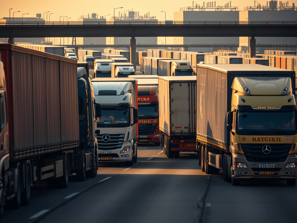
Back to the British roads. 6-wheelers, 8-wheelers, 12-wheelers, big heavy trucks often showing the wear and tear from journeying great distances depend on the motorway system. A constant flow of heavy goods moves day and night.

Looking at the trucks, some have UK registration plates, some have UK registration plates thrown over their original plates. Most drive under the registration plates of a country of origin or wherever their commercial operations are based. Each plate tells a story. LT is Lithuania. PL is Poland. H is Hungary. NL is Netherlands. D is Germany.

So, every day we have tens of thousands of trucks maintained and operated to standards set by the European Union (EU) on our roads. They are left-hand-drive. Their speedometers are in kilometres per hour.

It occurs to me – what does “sovereignty” mean when everyday looks like a day driving?

For sure, no British inspector checks the condition of each one of these trucks on a regular basis. For sure, truck driver’s hours are only occasionally checked. For sure, maintenance records are locked away in a filing cabinet.

In the world of absolute sovereignty none of this should be allowed. In fact, much of the above-described transport operations are continuing as they did before Brexit but with extra paperwork attached. Extra costs.

It’s an observation. It’s easily made when stuck between a couple of heavy goods vehicles on the motorway. Pragmatism may have led to a blind eye being turned to reality. We shouldn’t delude ourselves that Brexit has delivered anything useful in this respect.

Travel Educator

Travel is the great educator. Fundamentally – yes. My ordinary every day is extraordinary to someone. Just as their ordinary every day is extraordinary to me. There’s so much we take for granted, and we must, that we forget how strange our customs and practice can be.

Even if it’s so simple as bumping into people when they walk on the right and I walk on the left. Or I sneeze and the obligatory and automatic “bless you” takes me by surprise. Greetings can come as a shock too. Whereas if someone says, “are you going the same way?” might be taken as the introductory line of a serial killer in London, in a small country town it’s just a polite inquiry by a genuinely interested fellow traveller.

Does travel teach social skills? I’m not so on-side with that view. There’s no doubt that it can be a way to meet like minded people. That can often, on the downside, be a local bubble. Ending up chatting to likable people who are going through similar experiences. Identifying not with the people around but those who are similarly placed.

What’s a more regular encounter is the tall guy with the sharp elbows who doesn’t acknowledge that the person in the middle seat, namely me, is annoyed by how little care he’s taking with his lanky arms and legs. I suppose, if such occasions teach me anything it’s to not do what is being done to me. Especially when a homeward bound aircraft is on hold, going round and round, in bad weather trying to get into Heathrow. Time stands still.

One of the best realisations that flows from travel is that there’s a common humanity lurking everywhere on the planet. On the other hand, it’s not always obvious or the first encounter. I think, most people sit in the camp of being indifferent or helpful. Yes, a small percentage are out to do no good. Thankfully, they are a small percentage and best avoided at all costs.

Another realisation is that uncomfortable situations, like being lost after having misread the map App on my phone, are all part of life’s colourful pageant. There maybe moments of concern. I don’t like to use the word – fear. There’s generally a pathway back to the more familiar.

I’m not for one moment advocating taking unnecessary risks. Before wandering around any major city, it’s as well to do some research. To get a rough appreciation of the geography and what goes where. Like a layout of the metro map. It’s nice to have tall landmarks that sit of the skyline. The sun and a wristwatch always offer the most rudimentary navigation aides. Knowing that a river crosses the city or tourist congregate in a certain place works at nighttime.

If I probe my decades of memories of travel, a lot of vivid recollections come from unexpected discoveries. Afterall, part of travel is returning home and having stories to tell.

Tragic VoePass ATR72 Crash

2024 was going so well. Looking at the indicator of worldwide fatalities in commercial aviation for the first six-months of this year, and it is exceptionally low. The time between major fatal accidents across the globe is another indicator that my team once looked at on a regular basis. Aviation is an extremely safe mode of transport but when accidents happen, they can be devastating.

Yesterday, the situation changed in Brazil. A VoePass ATR72-500 aircraft[1], registration PS-VPB, flight number PTB2283 crashed in the Brazilian state of São Paulo. The twin-engine aircraft crashed in a residential location.

Yet unknown events resulted in a loss of control in-flight. On-line videos of the aircraft flying show a dive and then a spiralling decent to the ground. The aircraft was destroyed on impact, and it is reported that all lives were lost.

The publicly available flight data shows a sudden decent from a stable altitude[2]. The aircraft was about and hour and twenty minutes into its flight.

Looking at the video information it might appear that local weather may not have been a factor in the accident. However, there was known to be severe icing conditions at the altitude that the aircraft was flying.

It’s speculation on my part but unrecognised severe icing is one of the conditions that can bring about a catastrophic outcome for such an aircraft. It is sad to have to say that there is a record of a major accident to an ATR-72 that has some of the characteristics of this new accident.

In fact, it is one fatal accident that is etched on my mind given that it happened in late 1994, when I was still fresh in my job with the UK Civil Aviation Authority as an airworthiness surveyor. It’s known as much by its location as by the name of the aircraft, namely Roselawn[3]. The accident was extremely controversial at the time.

Crews are told that they may be operating in severe icing conditions but there is no specific regulatory requirement for on-board advisory or warning system on this generation of turboprop aircraft. An ice detection system can serve as a final warning to alert a crew that ice protection is needed.

Work to update the technical document; In-Flight Ice Detection System (FIDS) Minimum Operational Specification EUROCAE ED-103 is completed. Issued in April 2022, ED-103B – MOPS for In-Flight Icing Detection Systems is available[4].

In the case of the current accident, it is a matter for Brazil’s highly capable independent accident investigators to determine what happened. Anything I have written here is purely speculative.

POST 1: Reports of statements made by Agência Nacional de Aviação Civil (Anac) say that the aircraft was in good condition.

POST 2: Accident flight recorders have been recovered from the accident site. Flight recorders retrieved from crashed Voepass ATR 72-500 | Flight Global


[1] https://asn.flightsafety.org/wikibase/409335

[2] https://www.flightaware.com/live/flight/PSVPB/history/20240809/1450Z/SBCA/SBGR/tracklog

[3] https://www.faa.gov/lessons_learned/transport_airplane/accidents/N401AM

[4] https://eshop.eurocae.net/eurocae-documents-and-reports/ed-103b/

Sainsbury’s Sanctuary

As I left Reigate the temperature was up at 30C. It was oppressively hot. Sticky and brewing an immense storm. Not that I minded so much, since I seem to thrive in the heat. Dark shades on. Lightest tee-shirt I could find. Primative old iPhone 4S blasting out an upbeat medially.

Sitting in my black car, on black leather seats, with an air conditioning system that cessed to work about a year ago, was a special kind of heat treatment. Windows open. It was like being blown by a powerful hairdryer from two sides. Fortunately for me London’s M25 was moving. Going west. Maybe wiser people than me had made a choice to delay their journey, or not go anywhere at all. In between the eight wheeled trucks, the shafts of sunlight rained down like a Martian death ray.

Grassy embankments that had been lush green earlier in the year were now charred brown. Motorway roadworks that had been bogged down in slimy mud now dust bowls. Colourful heavy earth moving machinery working on its limits. Roadworkers looking as if they would rather be anywhere but where they were. Lucky ones sheltering in the shade.

My journey had not been without basic planning. I knew that the heaviest of storms was slowing making its way west to east across southern England. I got almost a quarter through my trip before the immense thunder clouds loomed off in the distance. The sunlight was slowly changing. Going from perfect clear blue skies, with a little haze, to a brooding caldron of shafts of bright light and rolling off-white clouds, towering up to the stratosphere.

Onto the M3 motorway going west. Through the roadworks. The perpetual roadworks, Where the nation’s highway planners are trying to correct mistakes that they made erecting “smart” motorways. Closing the running hard shoulder to erect new emergency stopping bays.

Still the temperature was shifting up and down around 30C. Would I get to my motorway exist before the downpour that now seemed inevitable? I slowed to let a heavy truck into the nearside lane. We were both keen to get off the gradually slowing motorway.

Almost as if I’d timed the weather and pressed a button for rain, it started on the slip road. Trickles at first. Dark grey skies and indications of what was to come. My car’s dashboard thermometer started to plummet. By the time the traffic lights turned green, and we passed over the M3, visibility was disappearing. In a mishmash of road traffic on that junction there was potential for every kind of accident.

Time to slow down. It doesn’t matter that the duel carriageway signs going north said 40 mph. It would have been foolish to speed beyond that limit. At that moment the monster storm was just getting going. The timing between lightning strikes and thunder was shortening. Still, I had a good 5-miles to go to a sanctuary.

Again, almost as if I’d timed the weather, I exited right to turn into a Sainsbury’s superstore as the dark monster above our heads did its worst. Great pools of water where splattered on the ground with rain falling like millions of tennis balls. It was time to sit out the storm and take a coffee. Already the temperature had dropped ten degrees.

My cosy coffee shop sanctuary was the number one best place to watch shoppers getting soaked as they trudged across the windswept car park. I certainly wasn’t going to be in that kind of hurry. I sat it out. Glad I did.